[ICRA20] Congestion-aware Evacuation Routing using Augmented Reality Devices
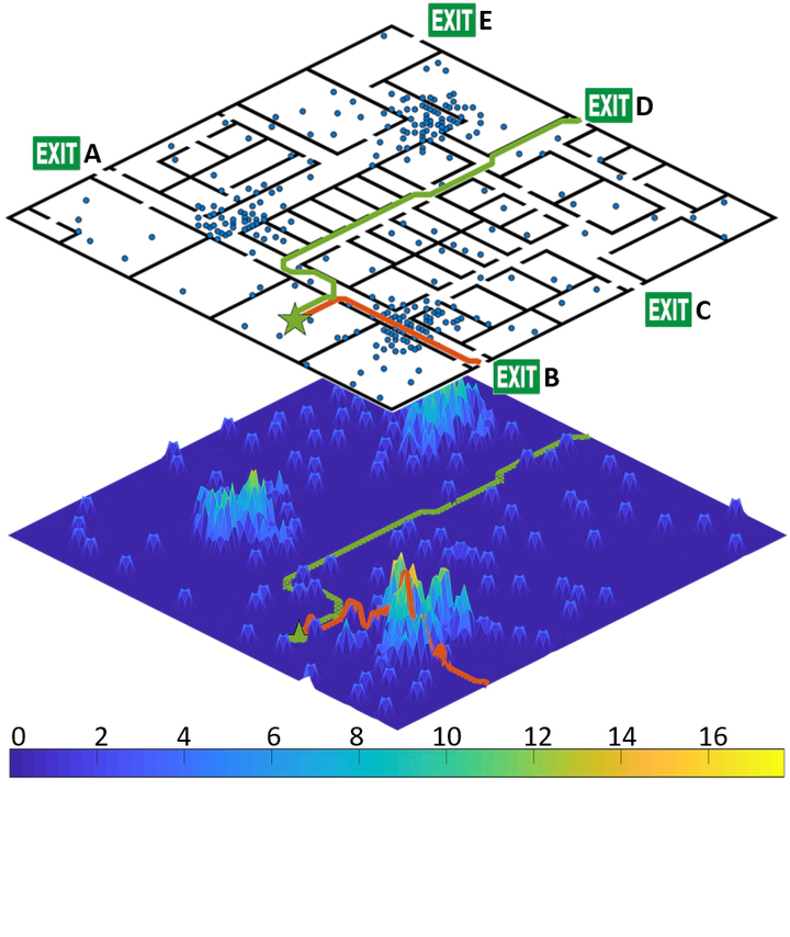 Evacuation routing with a density map. (Top) The floorplan and the distribution of evacuees (blue dots). (Bottom) The population density map indicates the magnitude of congestion. If a human agent (green star) followed the route generated by a naive planner in terms of the shorted path (in red) to Exit B, s/he would compete with other agents. Instead, the proposed system suggests a further, but more time-efficient evacuation route (in green) toward Exit D.
Abstract
We present a congestion-aware routing solution for indoor evacuation, which produces real-time individual-customized evacuation routes among multiple destinations while keeping tracks of all evacuees’ locations. A population density map, obtained on-the-fly by aggregating locations of evacuees from user-end AR devices, is used to model the congestion distribution inside a building. To efficiently search the evacuation route among all destinations, a variant of A* algorithm is devised to obtain the optimal solution in a single pass. In a series of simulated studies, we show that the proposed algorithm is more computationally optimized compared to classic path planning algorithms; it generates a more time-efficient evacuation route for each individual that minimizes the overall congestion. A complete system using AR devices is implemented for a pilot study in real-world environments, demonstrating the efficacy of the proposed approach.